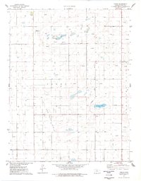
1976 Map of Tennis
USGS Topo · Published 1978About this map
The high plains of western Kansas in the mid-1970s are defined by a complex intersection of energy extraction and rail transport. The Atchison Topeka and Santa Fe railroad cuts a diagonal path through the southeastern corner of the quadrangle, serving small points like Gano and the settlement of Tennis. This area is heavily developed as an Oil and Gas Field, with a dense grid of oil wells and gas wells peppered throughout the landscape of Terry and Pleasant Valley. These industrial features exist alongside natural water bodies such as Sondreagger Lake and Corrigan Lake, while the Neiman Landing Strip indicates the importance of aerial access for managing these sprawling operations. The map reflects a landscape transformed by the 20th-century petroleum boom, where traditional agricultural section lines now share space with a sophisticated energy infrastructure.
Find a feature on this map
13 named features on this map. Tap any name to fly to it.
Don’t see what you’re looking for? This feature index may not catch every label — zoom into the map to look around manually.
Map Details
Editions of this 1976 Tennis Map
This is the sole edition of this map. No revisions or reprints were ever made.
Other maps of this area

1940 · Scott City
USGS Topo · 1:62,500

1941 · Modoc
USGS Topo · 1:62,500

1944 · Tennis
USGS Topo · 1:62,500

1951 · Scott City
USGS Topo · 1:62,500

1951 · Modoc
USGS Topo · 1:62,500

1955 · Scott City
USGS Topo · 1:250,000

1958 · Scott City
USGS Topo · 1:250,000
1965 · Wolf
USGS Topo · 1:24,000

1965 · Wolf NE
USGS Topo · 1:24,000
1976 · Lowe
USGS Topo · 1:24,000