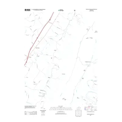
2013 Map of Tenth Legion
USGS Topo · Published 2013About this map
Catherine Furnace stands at the eastern edge of this landscape, a remnant of the region's industrial heritage near the base of the Massanutten range. This portion of the Shenandoah Valley shows a mix of agricultural tradition and modern infrastructure, where small settlements like Tenth Legion and Mauzy are connected by a network of rural routes such as Moores Mill Rd and Fairview Church Rd. The terrain transitions from the relatively level valley floor near Lincoln Hill and Arkton to the significant elevations of Big Mountain and First Mountain. The S Fork Shenandoah River winds through the southeastern corner, while numerous smaller waterways like Smith Cr and War Br drain the central valley. Local recreation and community life are represented by Camp Fair Haven and routes leading toward the valley's famous natural features along Endless Caverns Rd.
Find a feature on this map
82 named features on this map. Tap any name to fly to it.
Don’t see what you’re looking for? This feature index may not catch every label — zoom into the map to look around manually.
Map Details
Editions of this 2013 Tenth Legion Map
This is the sole edition of this map. No revisions or reprints were ever made.
Other maps of this area

1892 · Woodstock
USGS Topo · 1:125,000

1892 · Harrisonburg
USGS Topo · 1:125,000

1937 · Elkton
USGS Topo · 1:62,500

1941 · Harrisonburg
USGS Topo · 1:62,500

1942 · Mt Jackson
USGS Topo · 1:62,500

1943 · Harrisonburg
USGS Topo · 1:62,500

1946 · Mt Jackson
USGS Topo · 1:62,500

1947 · Mt Jackson
USGS Topo · 1:62,500

1947 · Broadway
USGS Topo · 1:62,500

1949 · Charlottesville
USGS Topo · 1:250,000