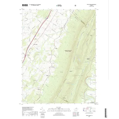
2019 Map of Tenth Legion
USGS Topo · Published 2019About this map
The ridge-and-valley landscape of the George Washington National Forest dominates the central and eastern portions of this region, defined by the imposing mass of Massanutten Mountain. To the west, the topography transitions into the fertile limestone lowlands where the historic settlement of Tenth Legion and the junction at Mauzy are situated along the path of N Valley Pike. The map illustrates a pattern of rural communities and family-named landmarks that have long shaped the agricultural and social life of the Shenandoah Valley.
Find a feature on this map
88 named features on this map. Tap any name to fly to it.
Don’t see what you’re looking for? This feature index may not catch every label — zoom into the map to look around manually.
Map Details
Editions of this 2019 Tenth Legion Map
This is the sole edition of this map. No revisions or reprints were ever made.
Other maps of this area

1892 · Woodstock
USGS Topo · 1:125,000

1892 · Harrisonburg
USGS Topo · 1:125,000

1937 · Elkton
USGS Topo · 1:62,500

1941 · Harrisonburg
USGS Topo · 1:62,500

1942 · Mt Jackson
USGS Topo · 1:62,500

1943 · Harrisonburg
USGS Topo · 1:62,500

1946 · Mt Jackson
USGS Topo · 1:62,500

1947 · Mt Jackson
USGS Topo · 1:62,500

1947 · Broadway
USGS Topo · 1:62,500

1949 · Charlottesville
USGS Topo · 1:250,000