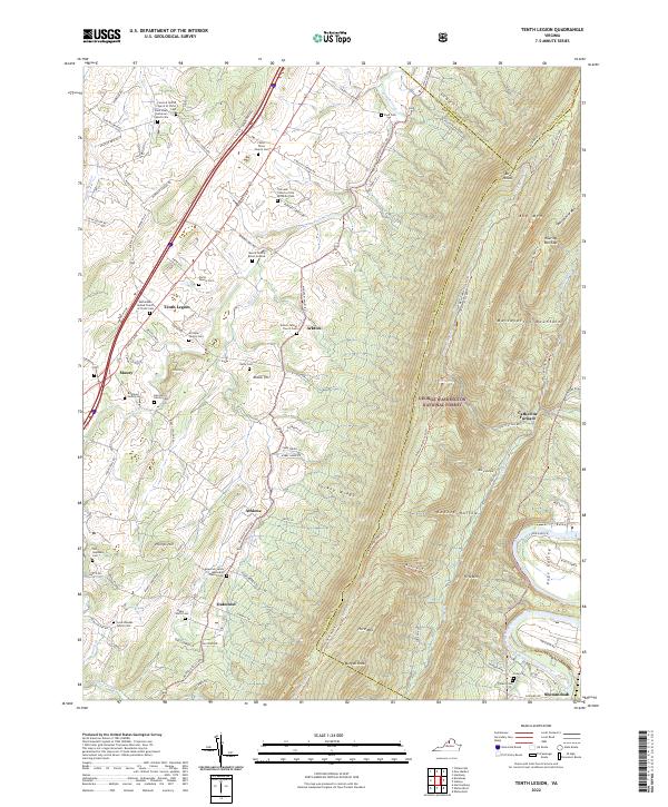
2022 Map of Tenth Legion
USGS Topo · Published 2022About this map
Massanutten Mountain dominates the eastern half of this Rockingham County landscape, its high ridges and deep hollows like Koontz Hollow and Lokey Hollow creating a natural barrier. Along the western valley, the small settlements of Tenth Legion, Mauzy, and Athlone follow the historical corridor of the N Valley Pike. This area is a significant site for genealogical research, densely populated with family burial grounds including the Zirkle - Driver Family Cem, Strickler Family Cem, and Moore Family Burial Grounds.
Find a feature on this map
110 named features on this map. Tap any name to fly to it.
Don’t see what you’re looking for? This feature index may not catch every label — zoom into the map to look around manually.
Map Details
Editions of this 2022 Tenth Legion Map
This is the sole edition of this map. No revisions or reprints were ever made.
Other maps of this area

1892 · Woodstock
USGS Topo · 1:125,000

1892 · Harrisonburg
USGS Topo · 1:125,000

1937 · Elkton
USGS Topo · 1:62,500

1941 · Harrisonburg
USGS Topo · 1:62,500

1942 · Mt Jackson
USGS Topo · 1:62,500

1943 · Harrisonburg
USGS Topo · 1:62,500

1946 · Mt Jackson
USGS Topo · 1:62,500

1947 · Mt Jackson
USGS Topo · 1:62,500

1947 · Broadway
USGS Topo · 1:62,500

1949 · Charlottesville
USGS Topo · 1:250,000