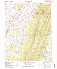
1994 Map of Tenth Legion
USGS Topo · Published 1997About this map
Massanutten Mountain dominates this mid-1990s landscape, serving as a natural boundary between the western agricultural valley and the George Washington National Forest. The valley floor is marked by a network of historic rural settlements like Tenth Legion, Mauzy, and Athlone, connected by roads tracing the path of Smith Creek. The area’s spiritual and communal roots are visible in the high density of country churches, including Bethlehem Ch and St Pauls Ch. Of particular note is the tourist and industrial history shown through Endless Caverns and the legacy of the regional iron industry at Catherine Furnace. A historic Covered Bridge spans a branch of the creek, while the Shenandoah River South Fork winds through the southeastern corner of the quadrangle, illustrating the enduring relationship between the region's hydrology and its settlement patterns.
Find a feature on this map
58 named features on this map. Tap any name to fly to it.
Don’t see what you’re looking for? This feature index may not catch every label — zoom into the map to look around manually.
Map Details
Editions of this 1994 Tenth Legion Map
This is the sole edition of this map. No revisions or reprints were ever made.
Other maps of this area

1892 · Woodstock
USGS Topo · 1:125,000

1892 · Harrisonburg
USGS Topo · 1:125,000

1937 · Elkton
USGS Topo · 1:62,500

1941 · Harrisonburg
USGS Topo · 1:62,500

1942 · Mt Jackson
USGS Topo · 1:62,500

1943 · Harrisonburg
USGS Topo · 1:62,500

1946 · Mt Jackson
USGS Topo · 1:62,500

1947 · Mt Jackson
USGS Topo · 1:62,500

1947 · Broadway
USGS Topo · 1:62,500

1949 · Charlottesville
USGS Topo · 1:250,000