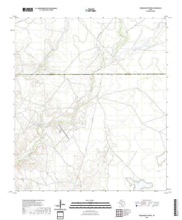
2022 Map of Tequesquite Spring
USGS Topo · Published 2022About this map
Tequesquite Spring marks a vital water source in this arid stretch of the South Texas brush country, situated along the Kinney and Maverick County line. The landscape is defined by the ephemeral drainages of Tequesquite Cr and Las Moras Creek, which carve through the terrain toward the Rio Grande basin. Local aviation and ranching history are centered at the Hughes Ranch Airport, a prominent landmark in an area otherwise characterized by vast ranch lands and isolated water features like L S Johnson Lake and Summers Lake. The presence of Cañon Grande indicates the localized relief found in this borderlands region, where transportation is limited to routes like FM 1908 and Ranch Rd 1908.
Find a feature on this map
13 named features on this map. Tap any name to fly to it.
Don’t see what you’re looking for? This feature index may not catch every label — zoom into the map to look around manually.
Map Details
Editions of this 2022 Tequesquite Spring Map
This is the sole edition of this map. No revisions or reprints were ever made.
Other maps of this area

1896 · Brackett
USGS Topo · 1:125,000

1897 · Brackett
USGS Topo · 1:125,000

1940 · Paloma
USGS Topo · 1:62,500

1940 · Quemado
USGS Topo · 1:62,500

1941 · Tequesquite Creek
USGS Topo · 1:62,500

1944 · Tequesquite Creek
USGS Topo · 1:62,500

1944 · Spofford
USGS Topo · 1:62,500

1958 · Eagle Pass
USGS Topo · 1:250,000

1958 · Del Rio
USGS Topo · 1:250,000

1964 · Del Rio
USGS Topo · 1:250,000