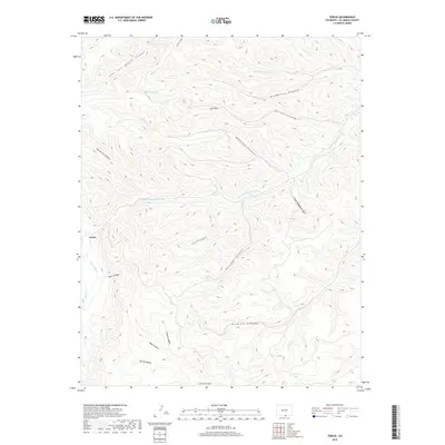
2019 Map of Tercio
USGS Topo · Published 2019About this map
Tercio stands as the primary human landmark in this section of Las Animas County, positioned where the drainage from Mine Canyon meets the local water systems. The landscape is defined by the S Fork Purgatoire River and its numerous tributary canyons, including Leon Canyon and Atamosito Canyon, which carve through the high elevations of the Ute Hills. This 2019 survey documents a terrain where water management is critical, evidenced by the Quatro Ditch and small alpine bodies like Bingham Lake and Dead Horse Lake. The naming of the canyons, such as Gallegos Canyon and Torres Canyon, reflects the deep regional history of the area's land use and early ranching or mining families who navigated these deep draws and ridges.
Find a feature on this map
22 named features on this map. Tap any name to fly to it.
Don’t see what you’re looking for? This feature index may not catch every label — zoom into the map to look around manually.
Map Details
Editions of this 2019 Tercio Map
This is the sole edition of this map. No revisions or reprints were ever made.
Other maps of this area

1891 · Spanish Peaks
USGS Topo · 1:125,000

1893 · Spanish Peaks
USGS Topo · 1:125,000

1895 · Spanish Peaks
USGS Topo · 1:125,000

1897 · Spanish Peaks
USGS Topo · 1:125,000

1900 · Spanish Peaks
USGS Topo · 1:125,000

1954 · Raton
USGS Topo · 1:250,000

1954 · Trinidad
USGS Topo · 1:250,000

1955 · Trinidad
USGS Topo · 1:250,000

1958 · Raton
USGS Topo · 1:250,000

1958 · Trinidad
USGS Topo · 1:250,000