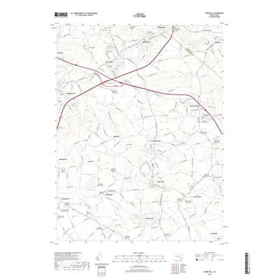
2019 Map of Terre Hill
USGS Topo · Published 2019About this map
Adamstown Ridge overlooks a landscape deeply rooted in the Anabaptist traditions of Lancaster County. This modern survey details a dense network of small communities including Terre Hill, Bowmansville, and Martindale, many of which center around significant religious and genealogical sites. The map is particularly notable for its documentation of numerous faith-based landmarks, such as the Centerville Mennonite Church Cem and the Muddy Creek Old Order Mennonite Cem.
Find a feature on this map
170 named features on this map. Tap any name to fly to it.
Don’t see what you’re looking for? This feature index may not catch every label — zoom into the map to look around manually.
Map Details
Editions of this 2019 Terre Hill Map
This is the sole edition of this map. No revisions or reprints were ever made.
Other maps of this area

1894 · Reading
USGS Topo · 1:62,500

1902 · Wernersville
USGS Topo · 1:62,500

1905 · Honey Brook
USGS Topo · 1:62,500

1906 · New Holland
USGS Topo · 1:62,500

1907 · Honeybrook
USGS Topo · 1:62,500

1908 · New Holland
USGS Topo · 1:62,500

1913 · Reading
USGS Topo · 1:62,500

1915 · Reading
USGS Topo · 1:62,500
1941 · Honeybrook
USGS Topo · 1:62,500

1941 · New Holland
USGS Topo · 1:62,500