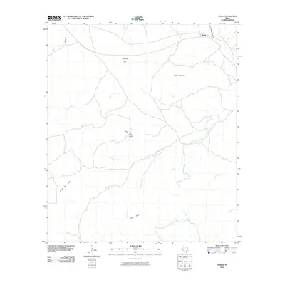
2010 Map of Tesnus
USGS Topo · Published 2010About this map
Tesnus lies at the northern edge of this West Texas landscape, where the Southern Pacific railroad tracks once defined the local economy. The terrain is dominated by prominent elevations such as Castle Mountain and the Shely Peaks, punctuated by seasonal drainages including Maxon Creek and Alamo Creek. To the west, the uniquely named Hells Half Acre marks a distinct topographic break, while Panther Gap provides a natural passage between the Panther Peaks. Settlement patterns appear sparse and ranch-oriented, centered around sites like Copeland and Trap. The drainage systems of China Draw and Fin Del Mundo Canyon highlight the complex arroyo network typical of Brewster County, illustrating the challenging geography that influenced early land use and transit routes in this part of the Trans-Pecos.
Find a feature on this map
14 named features on this map. Tap any name to fly to it.
Don’t see what you’re looking for? This feature index may not catch every label — zoom into the map to look around manually.
Map Details
Editions of this 2010 Tesnus Map
This is the sole edition of this map. No revisions or reprints were ever made.
Other maps of this area

1917 · Hood Spring
USGS Topo · 1:62,500

1918 · Bone Spring
USGS Topo · 1:125,000

1918 · Hood Spring
USGS Topo · 1:62,500

1918 · Dove Mountain
USGS Topo · 1:62,500

1920 · Longfellow
USGS Topo · 1:125,000

1920 · Marathon
USGS Topo · 1:62,500

1921 · Marathon
USGS Topo · 1:62,500

1931 · Hood Spring
USGS Topo · 1:62,500

1954 · Fort Stockton
USGS Topo · 1:250,000

1958 · Fort Stockton
USGS Topo · 1:250,000