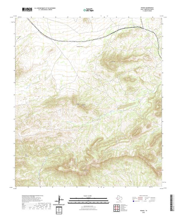
2022 Map of Tesnus
USGS Topo · Published 2022About this map
Castle Mtn and the surrounding high desert terrain of Brewster County define this landscape, where complex topography dictates the flow of intermittent waterways. The area is marked by significant elevation changes, ranging from the prominent Panther Peaks and Shely Peaks to the dramatic incision of Fin Del Mundo Canyon. These landforms create a natural corridor through Panther Gap, while ephemeral streams like Buffalo Soldier Cr and Maxon Cr reveal the drainage patterns of this arid environment.
Find a feature on this map
13 named features on this map. Tap any name to fly to it.
Don’t see what you’re looking for? This feature index may not catch every label — zoom into the map to look around manually.
Map Details
Editions of this 2022 Tesnus Map
This is the sole edition of this map. No revisions or reprints were ever made.
Other maps of this area

1917 · Hood Spring
USGS Topo · 1:62,500

1918 · Bone Spring
USGS Topo · 1:125,000

1918 · Hood Spring
USGS Topo · 1:62,500

1918 · Dove Mountain
USGS Topo · 1:62,500

1920 · Longfellow
USGS Topo · 1:125,000

1920 · Marathon
USGS Topo · 1:62,500

1921 · Marathon
USGS Topo · 1:62,500

1931 · Hood Spring
USGS Topo · 1:62,500

1954 · Fort Stockton
USGS Topo · 1:250,000

1958 · Fort Stockton
USGS Topo · 1:250,000