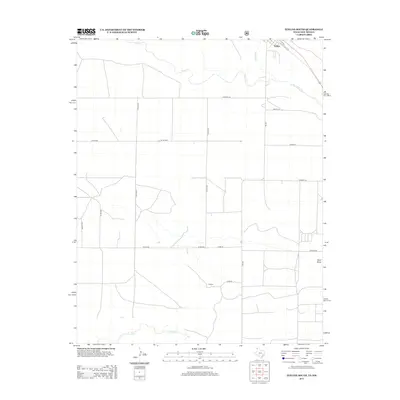
2012 Map of Texline South
USGS Topo · Published 2012About this map
Texline sits at the high-plains threshold of the Texas Panhandle and New Mexico, defined by a rigid grid of ranch roads and intermittent drainages. In this 2012 survey, the landscape is etched by the paths of Perico Cr and Carrizo Cr, which cut through the open country. The town of Higgins appears to the south along Dixon Rd, illustrating the dispersed settlement pattern characteristic of Dallam County. Named thoroughfares like Campsey Ln, Evans Ln, and Hershey Ln reveal the established property boundaries and family ranching heritage of the region. This document captures the intersection of high-altitude prairie hydrology and human infrastructure, from the seasonal flow of W Rita Blanca Cr to the southern reach of the Plainview road network near the state line.
Find a feature on this map
22 named features on this map. Tap any name to fly to it.
Don’t see what you’re looking for? This feature index may not catch every label — zoom into the map to look around manually.
Map Details
Editions of this 2012 Texline South Map
This is the sole edition of this map. No revisions or reprints were ever made.
Other maps of this area

1954 · Dalhart
USGS Topo · 1:250,000

1958 · Dalhart
USGS Topo · 1:250,000

1962 · Dalhart
USGS Topo · 1:250,000

1970 · Texline South
USGS Topo · 1:24,000

1970 · Clayton
USGS Topo · 1:24,000

1970 · Clayton SW
USGS Topo · 1:24,000

1970 · Texline North
USGS Topo · 1:24,000

1970 · Sedan
USGS Topo · 1:24,000

1970 · Sedan NE
USGS Topo · 1:24,000

1973 · Corlena
USGS Topo · 1:24,000