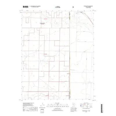
2019 Map of Texline South
USGS Topo · Published 2019About this map
The High Plains borderlands between Texas and New Mexico are defined here by the intersection of cattle country and high-desert drainage systems. Texline sits at the northern edge of the sheet, where the state line divides Union County and Dallam County. This area is characterized by vast open spaces within the Kiowa National Grassland, punctuated by family-named tracks such as Evans Ln, Campsey Ln, and Hershey Ln. The hydrology of the region is centered on ephemeral watercourses like W Rita Blanca Cr, Perico Cr, and the appropriately named Sand Draw. For those looking into local history, the Texline Cem serves as a primary genealogical landmark near the heart of the settlement, while the surrounding grid of section lines and county roads provides a framework for tracing early 21st-century land use.
Find a feature on this map
28 named features on this map. Tap any name to fly to it.
Don’t see what you’re looking for? This feature index may not catch every label — zoom into the map to look around manually.
Map Details
Editions of this 2019 Texline South Map
This is the sole edition of this map. No revisions or reprints were ever made.
Other maps of this area

1954 · Dalhart
USGS Topo · 1:250,000

1958 · Dalhart
USGS Topo · 1:250,000

1962 · Dalhart
USGS Topo · 1:250,000

1970 · Texline South
USGS Topo · 1:24,000

1970 · Clayton
USGS Topo · 1:24,000

1970 · Clayton SW
USGS Topo · 1:24,000

1970 · Texline North
USGS Topo · 1:24,000

1970 · Sedan
USGS Topo · 1:24,000

1970 · Sedan NE
USGS Topo · 1:24,000

1973 · Corlena
USGS Topo · 1:24,000