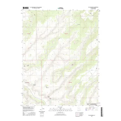
2017 Map of The Cheesebox
USGS Topo · Published 2017About this map
Natural Bridges National Monument borders the southeastern edge of this high-desert landscape, where the Sipapu Bridge stands as a primary landmark. The terrain is defined by deep incisions like Cheesebox Canyon and White Canyon, which reveal the complex drainage patterns of the Colorado Plateau. High relief dominates the topography, anchored by prominent formations such as The Cheesebox and Ram Mesa. Primitive routes, including Co Rd 227A and Deer Flat Rd, provide the only access through this desolate region of San Juan County. This survey illustrates a wilderness nearly devoid of permanent human settlement, instead highlighting natural features such as Found Mesa and Lone Butte. The presence of Hideout Canyon and K and L Canyon suggests a landscape historically utilized for its natural cover and geographic isolation, offering researchers a look at the area's protected and remote land management boundaries.
Find a feature on this map
31 named features on this map. Tap any name to fly to it.
Don’t see what you’re looking for? This feature index may not catch every label — zoom into the map to look around manually.
Map Details
Editions of this 2017 The Cheesebox Map
This is the sole edition of this map. No revisions or reprints were ever made.
Other maps of this area

1886 · Henry Mountains
USGS Topo · 1:250,000

1886 · Abajo
USGS Topo · 1:250,000

1892 · Abajo
USGS Topo · 1:250,000

1892 · Henry Mountains
USGS Topo · 1:250,000

1893 · Abajo
USGS Topo · 1:250,000

1935 · Elk Ridge
USGS Topo · 1:96,000

1940 · Elk Ridge
USGS Topo · 1:125,000

1952 · Mouth of Dark Canyon
USGS Topo · 1:62,500

1952 · Natural Bridges
USGS Topo · 1:62,500

1954 · White Canyon 4 NE
USGS Topo · 1:24,000