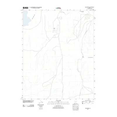
2011 Map of The Divide
USGS Topo · Published 2011About this map
Grass Valley and the high terrain of The Divide dominate this landscape in Washington County, Utah. The map documents a complex network of historical and modern transit routes, including the storied Honeymoon Trail Rd and the Arizona Strip Rd, which provide access through this arid environment towards the Arizona border. Water management is a central theme of the area's development, evidenced by the Frog Hollow Debris Basin Dam and the various drainage patterns like Sand Hollow Draw that cut through the plateaus near Little Creek Mountain. The presence of roads such as Cliffdweller Ranch Rd suggests the historical ranching activity that has long shaped land use in this part of the state.
Find a feature on this map
10 named features on this map. Tap any name to fly to it.
Don’t see what you’re looking for? This feature index may not catch every label — zoom into the map to look around manually.
Map Details
Editions of this 2011 The Divide Map
This is the sole edition of this map. No revisions or reprints were ever made.
Other maps of this area

1885 · St. George
USGS Topo · 1:250,000

1886 · Mt. Trumbull
USGS Topo · 1:250,000

1891 · St. George
USGS Topo · 1:250,000

1892 · Mt. Trumbull
USGS Topo · 1:250,000

1953 · Cedar City
USGS Topo · 1:250,000

1953 · Grand Canyon
USGS Topo · 1:250,000

1954 · La Verkin 4 NW
USGS Topo · 1:24,000

1954 · La Verkin 4 SW
USGS Topo · 1:24,000

1954 · Hurricane Cliffs 2 NW
USGS Topo · 1:24,000

1954 · La Verkin 3 NW
USGS Topo · 1:24,000