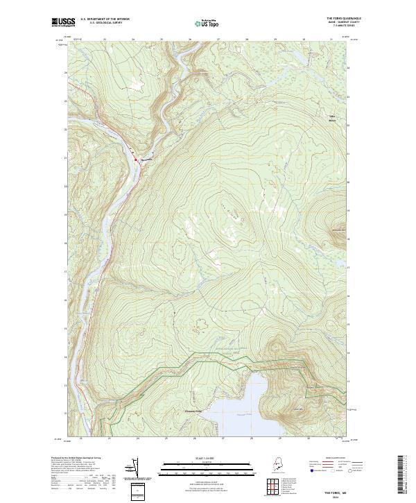
2024 Map of The Forks
USGS Topo · Published 2024About this map
The confluence of the Kennebec River and the Dead River serves as the central focal point for this Somerset County landscape, where the settlement of The Forks has long anchored the local geography. The topography is defined by significant elevations such as The Divide and Mosquito Mtn, while the southern reaches are dominated by the waters of Pleasant Pond and its surrounding peaks. This 2024 survey captures the modern alignment of the Appalachian National Scenic Trail as it traverses the highlands south of Holly Brook, providing a detailed record of the trail's path through the Maine woods. Notable water features like Moxie Falls and Moxie Stream suggest the drainage patterns of the high country, while a network of timber and access roads like Boise Rd and Flood Rd reflects the ongoing utility of the forest. The map also documents smaller remote settlements and seasonal locations including Lake Moxie and various family-named ponds.
Find a feature on this map
39 named features on this map. Tap any name to fly to it.
Don’t see what you’re looking for? This feature index may not catch every label — zoom into the map to look around manually.
Map Details
Editions of this 2024 The Forks Map
This is the sole edition of this map. No revisions or reprints were ever made.
Other maps of this area

1903 · Bingham
USGS Topo · 1:62,500

1905 · Bingham
USGS Topo · 1:62,500

1905 · The Forks
USGS Topo · 1:62,500

1907 · The Forks
USGS Topo · 1:62,500

1925 · Pierce Pond
USGS Topo · 1:48,000

1927 · Pierce Pond
USGS Topo · 1:62,500

1928 · Dead River
USGS Topo · 1:62,500

1931 · Dead River
USGS Topo · 1:48,000

1944 · Dead River
USGS Topo · 1:62,500

1944 · Pierce Pond
USGS Topo · 1:62,500