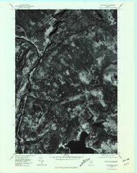
1977 Map of The Forks
USGS Topo · Published 1981About this map
The confluence of the Dead River and the Kennebec River forms the central geographic anchor of this Somerset County landscape. At this junction lies the small settlement of The Forks, historically a pivotal point for river-based transport and logging operations in Maine's north woods. The orthophoto imagery reveals the dense timberland and steep drainages that characterize the region, including the winding path of Moxie Stream as it flows toward the main river valley. To the south, the clear waters of Pleasant Pond sit at the base of the prominent Pleasant Pond Mountain, with the smaller settlement of Pleasant Pond visible along its shores. This 1977 aerial survey provides a clear view of the logging roads and natural corridors that defined the local economy and geography in the late 1970s, long before modern development altered the rural character of the Maine wilderness.
Find a feature on this map
8 named features on this map. Tap any name to fly to it.
Don’t see what you’re looking for? This feature index may not catch every label — zoom into the map to look around manually.
Map Details
Editions of this 1977 The Forks Map
This is the sole edition of this map. No revisions or reprints were ever made.
Other maps of this area

1903 · Bingham
USGS Topo · 1:62,500

1905 · Bingham
USGS Topo · 1:62,500

1905 · The Forks
USGS Topo · 1:62,500

1907 · The Forks
USGS Topo · 1:62,500

1925 · Pierce Pond
USGS Topo · 1:48,000

1927 · Pierce Pond
USGS Topo · 1:62,500

1928 · Dead River
USGS Topo · 1:62,500

1931 · Dead River
USGS Topo · 1:48,000

1944 · Dead River
USGS Topo · 1:62,500

1944 · Pierce Pond
USGS Topo · 1:62,500