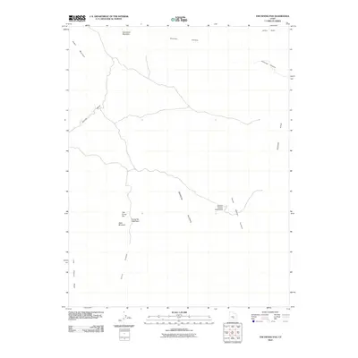
2010 Map of The Frying Pan
USGS Topo · Published 2010About this map
The Frying Pan and its namesake catchment basin center this topographical study of the Emery County high country. The landscape is defined by massive geographic depressions and ridges, including Segers Hole and Johns Hole to the north and east, while the northern boundary is dominated by the peaks of Cedar Mountain and East Cedar Mountain. These features reflect a dry environment where water management and natural drainage are critical, evidenced by the Frying Pan Catchment and Moroni Slopes Catchment.
Find a feature on this map
14 named features on this map. Tap any name to fly to it.
Don’t see what you’re looking for? This feature index may not catch every label — zoom into the map to look around manually.
Map Details
Editions of this 2010 The Frying Pan Map
This is the sole edition of this map. No revisions or reprints were ever made.
Other maps of this area

1885 · San Rafael
USGS Topo · 1:250,000

1885 · Fish Lake
USGS Topo · 1:250,000

1896 · Fish Lake
USGS Topo · 1:250,000

1952 · Wild Horse
USGS Topo · 1:62,500

1953 · Emery 4 NE
USGS Topo · 1:24,000

1953 · Emery 4 SE
USGS Topo · 1:24,000

1954 · Stinking Spring Creek 3 NW
USGS Topo · 1:24,000

1954 · Stinking Spring Creek 3 SW
USGS Topo · 1:24,000

1954 · Mt. Ellen 2 NW
USGS Topo · 1:24,000

1954 · Notom 1 NE
USGS Topo · 1:24,000