
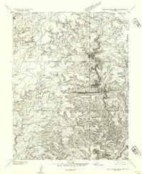
1954 Map of Stinking Spring Creek 3 SW
USGS Topo · Published 1954About this map
Nevills Bench and the stark geological platforms of Huntington Terrace dominate this mid-century preliminary survey of the San Rafael Swell area. The map documents a landscape defined by dramatic elevation changes and the erosive path of the Muddy River, which snakes through the southern portion of the quadrangle. In an area largely devoid of formal settlements, the presence of a single House near a Spring in the southeast corner provides a rare trace of human habitation, likely associated with ranching or early uranium exploration efforts common in Emery County during the early 1950s. The drainage patterns of Salt Wash and the surrounding terrain of Hagerman Terrace illustrate the complex topography that hindered early transit through this part of the Colorado Plateau.
Find a feature on this map
8 named features on this map. Tap any name to fly to it.
Don’t see what you’re looking for? This feature index may not catch every label — zoom into the map to look around manually.
Map Details
Editions of this 1954 Stinking Spring Creek 3 SW Map
This is the sole edition of this map. No revisions or reprints were ever made.
Other maps of this area

1885 · San Rafael
USGS Topo · 1:250,000

1885 · Fish Lake
USGS Topo · 1:250,000

1896 · Fish Lake
USGS Topo · 1:250,000

1952 · Wild Horse
USGS Topo · 1:62,500

1953 · Emery 4 NE
USGS Topo · 1:24,000

1953 · Emery 4 SE
USGS Topo · 1:24,000

1954 · Stinking Spring Creek 3 NW
USGS Topo · 1:24,000

1954 · Stinking Spring Creek 3 SE
USGS Topo · 1:24,000
1954 · Stinking Spring Creek 3 NE
USGS Topo · 1:24,000

1954 · Mt. Ellen 2 NE
USGS Topo · 1:24,000