
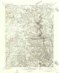
1954 Map of Stinking Spring Creek 3 SE
USGS Topo · Published 1954About this map
Muddy River winds through the southern reaches of this 1950s terrain study in Emery County, Utah. The landscape is defined by the significant elevations of Little Horse Mesa and Horse Mesa, which dominate the central and western portions of the quadrangle. This preliminary edition, based on 1951 aerial photography, provides a detailed look at the drainage patterns of the high desert before further development. Small water features like Little Horse Creek and a localized Seep suggest the scarce but vital water sources that shaped land use in this arid region. The map’s focus on topography and drainage reflects a period of intensive geological surveying by the Department of the Interior to document the more isolated stretches of the American West.
Find a feature on this map
5 named features on this map. Tap any name to fly to it.
Don’t see what you’re looking for? This feature index may not catch every label — zoom into the map to look around manually.
Map Details
Editions of this 1954 Stinking Spring Creek 3 SE Map
This is the sole edition of this map. No revisions or reprints were ever made.
Other maps of this area

1885 · San Rafael
USGS Topo · 1:250,000

1952 · Wild Horse
USGS Topo · 1:62,500

1953 · Temple Mtn
USGS Topo · 1:62,500

1954 · Stinking Springs Creek 4 SW
USGS Topo · 1:24,000

1954 · Stinking Spring Creek 3 NW
USGS Topo · 1:24,000

1954 · Stinking Spring Creek 4 NW
USGS Topo · 1:24,000

1954 · Stinking Spring Creek 3 SW
USGS Topo · 1:24,000
1954 · Stinking Spring Creek 3 NE
USGS Topo · 1:24,000

1954 · Mt. Ellen 1 NW
USGS Topo · 1:24,000

1954 · Mt. Ellen 2 NE
USGS Topo · 1:24,000