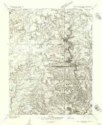
1954 Map of Stinking Spring Creek 3 NE
USGS Topo · Published 1954About this map
Sinbad Country dominates this 1954 preliminary survey of Emery County, Utah, revealing a landscape defined by dramatic geological incisions and high desert plateaus. The map captures the area shortly after the Department of the Interior and Geological Survey conducted 1953 field mapping, using aerial photography from 1951 to chart the complex drainage systems of Little Ocean Draw and Baptist Draw. Notable for its remote terrain, the sheet highlights distinct flatlands like Taylor Flat and McKay Flat which sit above the deep winding corridor of Cistern Canyon. The presence of small reservoirs, simply labeled Dam, suggests the vital importance of water management for livestock in this arid environment. This edition preserves the rugged character of Horse Valley and its surrounding canyons before more modern infrastructure or intensive land use altered the local topography.
Find a feature on this map
9 named features on this map. Tap any name to fly to it.
Don’t see what you’re looking for? This feature index may not catch every label — zoom into the map to look around manually.
Map Details
Editions of this 1954 Stinking Spring Creek 3 NE Map
This is the sole edition of this map. No revisions or reprints were ever made.
Other maps of this area

1885 · San Rafael
USGS Topo · 1:250,000

1952 · Wild Horse
USGS Topo · 1:62,500

1952 · San Rafael Knob
USGS Topo · 1:62,500

1953 · Stinking Spring Creek 2 SE
USGS Topo · 1:24,000

1953 · Temple Mtn
USGS Topo · 1:62,500

1954 · Stinking Springs Creek 4 SW
USGS Topo · 1:24,000

1954 · Stinking Spring Creek 3 NW
USGS Topo · 1:24,000

1954 · Stinking Spring Creek 3 SE
USGS Topo · 1:24,000

1954 · Stinking Spring Creek 4 NW
USGS Topo · 1:24,000

1954 · Stinking Spring Creek 2 SW
USGS Topo · 1:24,000