
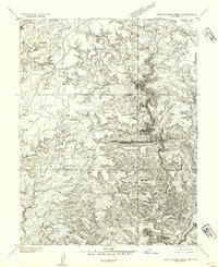
1954 Map of Stinking Springs Creek 4 SW
USGS Topo · Published 1954About this map
San Rafael Desert dominates this 1950s preliminary survey of Emery County, Utah, where high mesas drop sharply into vast arid basins. The topography is defined by the massive East Mesa, which occupies much of the western portion of the sheet, and the distinctive landmark of Wild Horse Butte. To the north, the isolated formation of Mollys Castle stands as a prominent navigational marker in an otherwise open landscape. Hydrology in this desert environment is sparse, centered on the drainage of Wild Horse Creek and isolated water sources like Buckskin Spring. This map was produced using aerial photography from the early 1950s, capturing the area before major modern developments altered the access to these remote geological features. The presence of Well Draw suggests the critical importance of water management and natural drainage paths for anyone traversing or ranching this portion of the Utah interior.
Find a feature on this map
8 named features on this map. Tap any name to fly to it.
Don’t see what you’re looking for? This feature index may not catch every label — zoom into the map to look around manually.
Map Details
Editions of this 1954 Stinking Springs Creek 4 SW Map
This is the sole edition of this map. No revisions or reprints were ever made.
Other maps of this area

1885 · San Rafael
USGS Topo · 1:250,000

1952 · Wild Horse
USGS Topo · 1:62,500

1953 · Temple Mtn
USGS Topo · 1:62,500

1954 · Stinking Spring Creek 3 SE
USGS Topo · 1:24,000

1954 · Stinking Spring Creek 4 NE
USGS Topo · 1:24,000

1954 · Stinking Spring Creek 4 NW
USGS Topo · 1:24,000

1954 · Stinking Spring Creek 4 SE
USGS Topo · 1:24,000
1954 · Stinking Spring Creek 3 NE
USGS Topo · 1:24,000

1954 · Mt. Ellen 1 NW
USGS Topo · 1:24,000

1954 · Mt. Ellen 2 NE
USGS Topo · 1:24,000