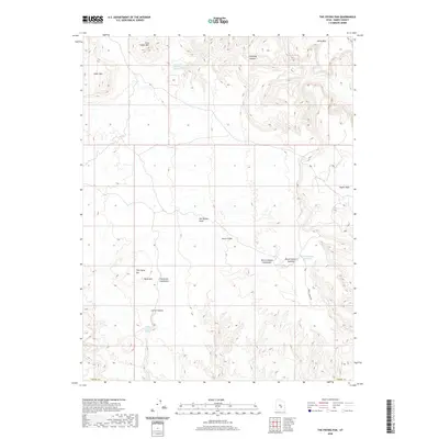
2020 Map of The Frying Pan
USGS Topo · Published 2020About this map
San Rafael Swell dominates this landscape in Emery County, where intricate erosion patterns have carved out dramatic landforms. The high elevation of Cedar Mtn and East Cedar Mtn overlooks several distinct geological depressions, including Johns Hole and Segers Hole. Water management in this arid environment is evident through the naming of Horse Heaven Reservoir and catchment areas such as the Moroni Slopes Catchment and Frying Pan Catchment. These features highlight the importance of capturing runoff from the surrounding peaks. The namesake feature, The Frying Pan, sits adjacent to Table Mtn, creating a unique geographical pocket. Traces of historical land use are found at isolated water sources like Corral Spring and East Cedar Mountain Spring, which likely served as vital stops for livestock and travelers traversing Chimney Canyon or Corral Canyon.
Find a feature on this map
17 named features on this map. Tap any name to fly to it.
Don’t see what you’re looking for? This feature index may not catch every label — zoom into the map to look around manually.
Map Details
Editions of this 2020 The Frying Pan Map
This is the sole edition of this map. No revisions or reprints were ever made.
Other maps of this area

1885 · San Rafael
USGS Topo · 1:250,000

1885 · Fish Lake
USGS Topo · 1:250,000

1896 · Fish Lake
USGS Topo · 1:250,000

1952 · Wild Horse
USGS Topo · 1:62,500

1953 · Emery 4 NE
USGS Topo · 1:24,000

1953 · Emery 4 SE
USGS Topo · 1:24,000

1954 · Stinking Spring Creek 3 NW
USGS Topo · 1:24,000

1954 · Stinking Spring Creek 3 SW
USGS Topo · 1:24,000

1954 · Mt. Ellen 2 NW
USGS Topo · 1:24,000

1954 · Notom 1 NE
USGS Topo · 1:24,000