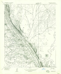
1957 Map of The Gap SW
USGS Topo · Published 1957About this map
Navajo Indian Reservation lands dominate this mid-century topographic study, centered on the settlement of The Gap and the surrounding high desert terrain. The landscape is defined by the significant drainage of Hamblin Wash, which carves through the earth between the Kaibito Plateau and the edge of the Painted Desert. Throughout the territory, individual Hogan and Hogans dwellings are marked, reflecting the traditional settlement patterns and land use of the area. Water management in this arid environment is evident through several small features like Windmill and a Reservoir, which supported local life and livestock. The 1950s infrastructure is primarily limited to Highway 89 and various unimproved trails that traverse the rugged topography of Crooked Ridge and pass near the distinct volcanic profile of Black Peak.
Find a feature on this map
15 named features on this map. Tap any name to fly to it.
Don’t see what you’re looking for? This feature index may not catch every label — zoom into the map to look around manually.
Map Details
Editions of this 1957 The Gap SW Map
This is the sole edition of this map. No revisions or reprints were ever made.
Other maps of this area

1886 · Echo Cliffs
USGS Topo · 1:250,000

1891 · Echo Cliffs
USGS Topo · 1:250,000

1954 · Shinumo Altar NE
USGS Topo · 1:24,000

1954 · Shinumo Altar SE
USGS Topo · 1:24,000

1954 · Shinumo Altar
USGS Topo · 1:62,500

1955 · Blue Spring NE
USGS Topo · 1:24,000

1955 · Moa Ave NW
USGS Topo · 1:24,000

1955 · Blue Spring
USGS Topo · 1:62,500

1956 · Marble Canyon
USGS Topo · 1:250,000

1959 · Marble Canyon
USGS Topo · 1:250,000