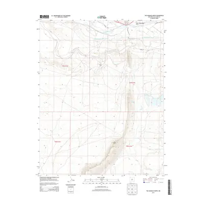
2013 Map of The Hogback North
USGS Topo · Published 2013About this map
The sharp monocline of The Hogback dominates this landscape in San Juan County, cutting through a high desert region defined by the confluence of the San Juan River and the Chaco River. In the early 21st century, this area represents a complex intersection of natural geology and human engineering. The presence of Hogback Field indicates the importance of local energy extraction, while the Fruitland Irrigation Canal and Hogback Canal demonstrate how water is diverted from the major rivers to support the surrounding environment. To the northeast, the Jewett Waterflow Valley serves as a significant riparian feature. Transportation across these arid lands is managed through a network of specialized routes, including Indian Service Route 162 and San Juan Charter Rd, which provide access to remote areas like Hogback Spring and the drainage of Chinde Wash.
Find a feature on this map
17 named features on this map. Tap any name to fly to it.
Don’t see what you’re looking for? This feature index may not catch every label — zoom into the map to look around manually.
Map Details
Editions of this 2013 The Hogback North Map
This is the sole edition of this map. No revisions or reprints were ever made.
Other maps of this area

1889 · Chaco
USGS Topo · 1:250,000

1892 · Chaco
USGS Topo · 1:250,000

1927 · Sulphur Spring
USGS Topo · 1:96,000

1928 · Kirtland
USGS Topo · 1:125,000

1932 · Kirtland
USGS Topo · 1:125,000

1934 · Chimney Rock
USGS Topo · 1:62,500

1936 · Chimney Rock
USGS Topo · 1:62,500

1954 · Shiprock
USGS Topo · 1:250,000

1958 · Shiprock
USGS Topo · 1:250,000

1959 · Shiprock
USGS Topo · 1:250,000