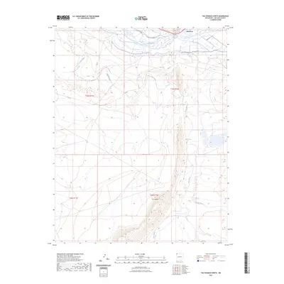
2023 Map of The Hogback North
USGS Topo · Published 2023About this map
The confluence of the San Juan River and the Chaco River forms the geographical heart of this San Juan County landscape. Just north of these waters, the settlement of Waterflow sits alongside the Hogback Canal, reflecting the critical role of irrigation in this arid river valley. The map is dominated by the dramatic uplift of The Hogback, a sharp ridge that defines the local geology and channels drainage into seasonal features like Chinde Wash. Transportation patterns here are a mix of modern infrastructure and older routes, including Indian Svc Rte 36 and the descriptive Old N36 Dirt Rd. Local history researchers will find particular interest in the location of Hogback Spring, a vital water source in an otherwise high-desert environment.
Find a feature on this map
16 named features on this map. Tap any name to fly to it.
Don’t see what you’re looking for? This feature index may not catch every label — zoom into the map to look around manually.
Map Details
Editions of this 2023 The Hogback North Map
This is the sole edition of this map. No revisions or reprints were ever made.
Other maps of this area

1889 · Chaco
USGS Topo · 1:250,000

1892 · Chaco
USGS Topo · 1:250,000

1927 · Sulphur Spring
USGS Topo · 1:96,000

1928 · Kirtland
USGS Topo · 1:125,000

1932 · Kirtland
USGS Topo · 1:125,000

1934 · Chimney Rock
USGS Topo · 1:62,500

1936 · Chimney Rock
USGS Topo · 1:62,500

1954 · Shiprock
USGS Topo · 1:250,000

1958 · Shiprock
USGS Topo · 1:250,000

1959 · Shiprock
USGS Topo · 1:250,000