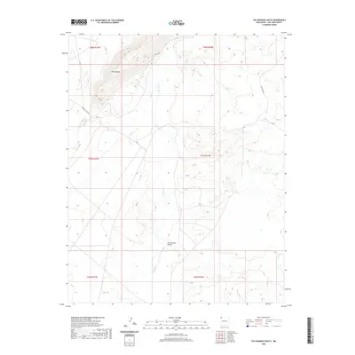
2020 Map of The Hogback South
USGS Topo · Published 2020About this map
The Hogback dominates this corner of the San Juan Basin, its distinctive ridgeline cutting across the northwestern quadrant. Below this geological landmark, the Chaco River meanders southward through a desert landscape defined by broad drainages and service roads. The water network is further detailed by the inclusion of Coal Cr and the winding course of Cottonwood Arroyo, which join the primary river system. This 2020 topographic record shows a territory managed through specialized infrastructure, notably the Indian Svc Rte 5017 and Ind Sr 5083. The modern character of the area is underscored by the presence of the Pinto Reroute and the numbered route N 4104, mapping the movement of people and industry through the Shiprock Agency region.
Find a feature on this map
14 named features on this map. Tap any name to fly to it.
Don’t see what you’re looking for? This feature index may not catch every label — zoom into the map to look around manually.
Map Details
Editions of this 2020 The Hogback South Map
This is the sole edition of this map. No revisions or reprints were ever made.
Other maps of this area

1889 · Chaco
USGS Topo · 1:250,000

1892 · Chaco
USGS Topo · 1:250,000

1927 · Sulphur Spring
USGS Topo · 1:96,000

1928 · Kirtland
USGS Topo · 1:125,000

1932 · Kirtland
USGS Topo · 1:125,000

1954 · Shiprock
USGS Topo · 1:250,000

1958 · Shiprock
USGS Topo · 1:250,000

1959 · Shiprock
USGS Topo · 1:250,000
1966 · The Hogback North
USGS Topo · 1:24,000
1966 · Sulphur Spring
USGS Topo · 1:24,000