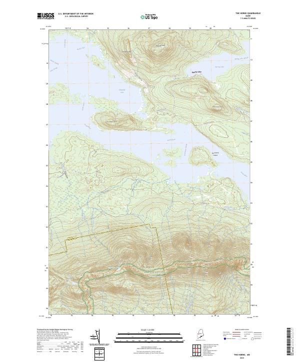
2024 Map of The Horns
USGS Topo · Published 2024About this map
Mt Bigelow and the high ridge of the Bigelow Range dominate this landscape along the border of Somerset and Franklin counties. The Appalachian National Scenic Trail traverses the southern peaks, connecting The Horns Pond, West Peak, and Avery Peak. To the north, the waters of Flagstaff Lake and the Dead River fill the valley, surrounding landmarks like Hurricane Island and Jim Eaton Hill. The presence of Long Falls Dam Rd and various forest roads like W Flagstaff Rd provide the only modern terrestrial access to this remote region of timber and water. Between the heights of Flagstaff Mtn and the isolated Spring Lake, the map traces the drainage of numerous small waterways, including Viles Brook and Hurricane Brook, which define the topography of this undeveloped mountain terrain.
Find a feature on this map
32 named features on this map. Tap any name to fly to it.
Don’t see what you’re looking for? This feature index may not catch every label — zoom into the map to look around manually.
Map Details
Editions of this 2024 The Horns Map
This is the sole edition of this map. No revisions or reprints were ever made.
Other maps of this area

1925 · Pierce Pond
USGS Topo · 1:48,000

1927 · Pierce Pond
USGS Topo · 1:62,500

1928 · Spencer
USGS Topo · 1:48,000

1928 · Dead River
USGS Topo · 1:62,500

1928 · Stratton
USGS Topo · 1:48,000

1931 · Dead River
USGS Topo · 1:48,000

1932 · Stratton
USGS Topo · 1:62,500

1932 · Spencer
USGS Topo · 1:62,500

1944 · Dead River
USGS Topo · 1:62,500

1944 · Pierce Pond
USGS Topo · 1:62,500
Featured Places
- Wyman Township, ME
- Dead River Township, ME
- Bigelow Township, ME
- Spring Lake Township, ME
- Flagstaff Township, ME