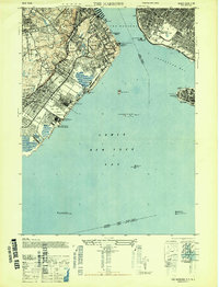
1947 Map of The Narrows
USGS Topo · Published 1947About this map
Staten Island Rapid Transit lines anchor the eastern shore of Staten Island in this post-war survey, tracing a path through established neighborhoods like Stapleton, Clifton, and Dongan Hills. The landscape is a mix of dense residential development and significant institutional footprints, including the US Marine Hospital and the sprawling Moravian Cemetery. Military presence is a defining characteristic of the era, with the U S Military Reservation at Miller Field and the strategic fortifications of Fort Wadsworth and Fort Lafayette guarding The Narrows.
Find a feature on this map
65 named features on this map. Tap any name to fly to it.
Don’t see what you’re looking for? This feature index may not catch every label — zoom into the map to look around manually.
Map Details
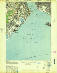
Editions of this 1947 The Narrows Map
2 editions found
Other maps of this area

1888 · Sandy Hook
USGS Topo · 1:62,500

1889 · Brooklyn
USGS Topo · 1:62,500

1891 · Brooklyn
USGS Topo · 1:62,500

1893 · Sandy Hook
USGS Topo · 1:62,500

1897 · Brooklyn
USGS Topo · 1:62,500

1898 · Staten Island
USGS Topo · 1:62,500

1898 · Brooklyn
USGS Topo · 1:62,500

1900 · Passaic
USGS Topo · 1:125,000

1900 · Staten Island
USGS Topo · 1:62,500

1900 · Brooklyn
USGS Topo · 1:62,500