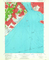
1955 Map of The Narrows
USGS Topo · Published 1965About this map
Fort Wadsworth and Fort Hamilton stand as coastal sentinels on either side of the iconic water gap known as The Narrows, connecting the upper and lower harbors. This mid-1950s survey detail reveals a transition in Staten Island’s development, from the dense residential pockets of Rosebank and Clifton to the open coastal grounds of Miller Field. The island's geography is defined by the heights of Todt Hill and Grymes Hill, the latter hosting Notre Dame College and Wagner Memorial College. Along the shoreline, recreational and maritime life is evident at Midland Beach and New Dorp Beach, while the Staten Island Rapid Transit line provides the backbone for commuters between communities like Dongan Hills and Grant City. Farther out in Lower New York Bay, Hoffman Island and Swinburne Island serve as isolated landmarks near the busy shipping lanes of the Ambrose Channel.
Find a feature on this map
90 named features on this map. Tap any name to fly to it.
Don’t see what you’re looking for? This feature index may not catch every label — zoom into the map to look around manually.
Map Details
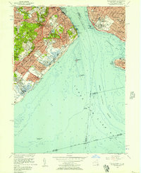
Editions of this 1955 The Narrows Map
2 editions found
Other maps of this area

1888 · Sandy Hook
USGS Topo · 1:62,500

1889 · Brooklyn
USGS Topo · 1:62,500

1891 · Brooklyn
USGS Topo · 1:62,500

1893 · Sandy Hook
USGS Topo · 1:62,500

1897 · Brooklyn
USGS Topo · 1:62,500

1898 · Staten Island
USGS Topo · 1:62,500

1898 · Brooklyn
USGS Topo · 1:62,500

1900 · Passaic
USGS Topo · 1:125,000

1900 · Staten Island
USGS Topo · 1:62,500

1900 · Brooklyn
USGS Topo · 1:62,500