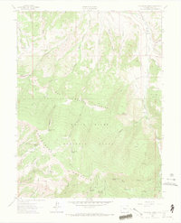
1962 Map of The Seven Hermits
USGS Topo · Published 1969About this map
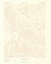
Hardscrabble Mountain and North Hardscrabble Mountain anchor the high-altitude terrain of the White River National Forest in this early 1960s study of Eagle County. The landscape is defined by a dense network of water management features, including several high-mountain reservoirs such as Mc Hatten Reservoir, Yates Reservoir, and Hells Hole Reservoir. These catchments, along with named irrigation works like the Love and Potter Ditch and Bemis Ditch, suggest a carefully managed watershed supporting local agriculture and ranching interests in the valleys below.
Find a feature on this map
58 named features on this map. Tap any name to fly to it.
Don’t see what you’re looking for? This feature index may not catch every label — zoom into the map to look around manually.
Map Details
Editions of this 1962 The Seven Hermits Map
4 editions found
Other maps of this area

1909 · Mount Jackson
USGS Topo · 1:125,000

1911 · Mount Jackson
USGS Topo · 1:125,000

1957 · Leadville
USGS Topo · 1:250,000

1959 · Leadville
USGS Topo · 1:250,000

1960 · Leadville
USGS Topo · 1:250,000
1961 · Toner Reservoir
USGS Topo · 1:24,000

1961 · Red Creek
USGS Topo · 1:24,000

1962 · Leadville
USGS Topo · 1:250,000

1962 · Gypsum
USGS Topo · 1:24,000
1962 · Suicide Mountain
USGS Topo · 1:24,000