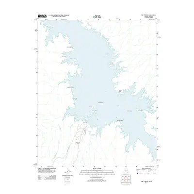
2012 Map of The Temple
USGS Topo · Published 2012About this map
Lake Mead dominates this high-resolution survey, revealing the intricate shoreline and recreational infrastructure of the Arizona and Nevada borderlands. The southern portion of the map is anchored by Temple Bar, a major access point featuring the Temple Bar Marina, an airport, and the Temple Bar Boat Anchorage. This area serves as a gateway to the Temple Basin, where the desert terrain meets the water in a complex series of inlets and coves like Monkey Cove and Ladder Cove.
Find a feature on this map
36 named features on this map. Tap any name to fly to it.
Don’t see what you’re looking for? This feature index may not catch every label — zoom into the map to look around manually.
Map Details
Editions of this 2012 The Temple Map
This is the sole edition of this map. No revisions or reprints were ever made.
Other maps of this area

1886 · Camp Mohave
USGS Topo · 1:250,000

1886 · Saint Thomas
USGS Topo · 1:250,000

1892 · Camp Mohave
USGS Topo · 1:250,000

1893 · Saint Thomas
USGS Topo · 1:250,000

1926 · Bonelli
USGS Topo · 1:96,000

1942 · Camp Mohave
USGS Topo · 1:250,000

1947 · Kingman
USGS Topo · 1:250,000

1948 · Kingman
USGS Topo · 1:250,000

1953 · Iceberg Canyon
USGS Topo · 1:62,500

1953 · Virgin Basin
USGS Topo · 1:62,500