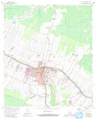
2024 Map of Thibodaux
USGS Topo · Published 2024About this map
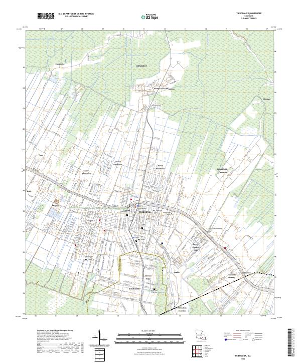
Bayou Lafourche serves as the central artery for this part of Lafourche Parish, where the historic footprint of the sugar industry remains visible through numerous named estates. Locations like Orange Grove Plantation, Abby Plantation, and Rienzi Plantation reflect the deep agricultural heritage that shaped the region's land divisions and settlement patterns. The city of Thibodaux sits at the heart of this network, housing the Lafourche Parish Courthouse Annex and the sprawling campus of Nicholls State University.
Find a feature on this map
229 named features on this map. Tap any name to fly to it.
Don’t see what you’re looking for? This feature index may not catch every label — zoom into the map to look around manually.
Map Details
Editions of this 2024 Thibodaux Map
This is the sole edition of this map. No revisions or reprints were ever made.
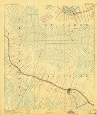
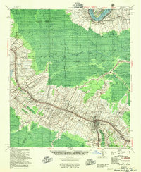
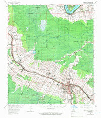
Historical Maps of Acadian Villa Through Time
6 maps found