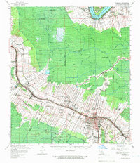
1962 Map of Thibodaux
USGS Topo · Published 1966About this map
The Mississippi River creates a distinctive serpentine corridor at Rich Bend and Pikes Peak in this 1962 survey of Louisiana’s sugar country. The landscape is defined by the historic long-lot land divisions that extend from the river and bayous into the surrounding marshlands, supporting numerous named estates such as Oak Alley, Madewood, and Rienzi Plantation. These agricultural footprints are interwoven with industrial developments, including the Chacahoula Oil and Gas Field and a network of pipelines.
Find a feature on this map
75 named features on this map. Tap any name to fly to it.
Don’t see what you’re looking for? This feature index may not catch every label — zoom into the map to look around manually.
Map Details
Editions of this 1962 Thibodaux Map
This is the sole edition of this map. No revisions or reprints were ever made.
Other maps of this area

1892 · Lac Des Allemands
USGS Topo · 1:62,500

1892 · Mount Airy
USGS Topo · 1:62,500

1892 · Gibson
USGS Topo · 1:62,500

1892 · Houma
USGS Topo · 1:62,500

1892 · Donaldsonville
USGS Topo · 1:62,500

1892 · Thibodaux
USGS Topo · 1:62,500

1897 · Gibson
USGS Topo · 1:62,500

1927 · Thibodaux NW
USGS Topo · 1:31,680

1932 · Lac Des Allemands NW
USGS Topo · 1:31,680

1932 · Lac Des Allemands SW
USGS Topo · 1:31,680