
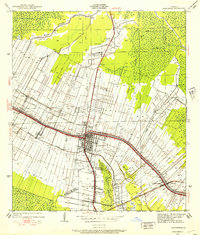
1927 Map of Thibodaux NW
USGS Topo · Published 1927About this map
Bayou Lafourche anchors the western edge of this territory, where the complex transition from cultivated riverfront land to dense swampland is clearly documented. The landscape is defined by long, narrow land grants stretching away from the water, a signature of French colonial settlement patterns that persisted into the early 20th century. Clusters of activity are centered around plantation-era names like Madewood, Elmfield, and Ingleside, while the interior remains a vast expanse of cypress and gum swamp dominated by Bayou Verret and Bayou Traverse. Social infrastructure for these rural communities is recorded through features like the St Thomas Sch, Woodlawn Ch, and Mt Campbell Ch. The engineering efforts of the State of Louisiana Board of State Engineers are visible in the drainage network, including the Cancienne Canal, designed to manage the delicate hydrology of the Assumption Parish basin.
Find a feature on this map
25 named features on this map. Tap any name to fly to it.
Don’t see what you’re looking for? This feature index may not catch every label — zoom into the map to look around manually.
Map Details
Editions of this 1927 Thibodaux NW Map
This is the sole edition of this map. No revisions or reprints were ever made.
Other maps of this area

1892 · Donaldsonville
USGS Topo · 1:62,500

1892 · Thibodaux
USGS Topo · 1:62,500

1932 · Thibodaux NE
USGS Topo · 1:31,680

1932 · Thibodaux SE
USGS Topo · 1:31,680

1932 · Thibodaux SW
USGS Topo · 1:31,680

1936 · White Castle
USGS Topo · 1:62,500

1938 · Labadieville
USGS Topo · 1:24,000
1938 · Lafourche
USGS Topo · 1:24,000

1939 · Donaldsonville
USGS Topo · 1:62,500

1940 · Lagan
USGS Topo · 1:31,680