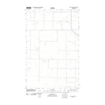
2010 Map of Thief Lake NE
USGS Topo · Published 2010About this map
Oak Hill Cemetery stands as a quiet landmark in this section of Roseau County, situated near the corner of 230th St and the South Fork Roseau River. The landscape is defined by the rigid geometry of the Public Land Survey System, with a dense grid of gravel and paved roads including County Hwy-124 and County Hwy-14 that partition the flat agricultural terrain. The river, snaking through the northeastern corner, provides the only natural deviation from the rectilinear road network. This 2010 survey by the U.S. Geological Survey reflects the enduring rural character of northern Minnesota, where family-named roads like 360th Ave and 370th Ave trace the boundaries of long-established farmsteads and rural townships.
Find a feature on this map
17 named features on this map. Tap any name to fly to it.
Don’t see what you’re looking for? This feature index may not catch every label — zoom into the map to look around manually.
Map Details
Editions of this 2010 Thief Lake NE Map
This is the sole edition of this map. No revisions or reprints were ever made.
Other maps of this area

1918 · Goos
USGS Topo · 1:62,500

1918 · Pencer
USGS Topo · 1:62,500

1918 · Roseau
USGS Topo · 1:62,500

1918 · Garland
USGS Topo · 1:62,500

1943 · Goos
USGS Topo · 1:62,500

1954 · Roseau
USGS Topo · 1:250,000

1957 · Roseau
USGS Topo · 1:250,000

1958 · Roseau
USGS Topo · 1:250,000
1966 · Fox
USGS Topo · 1:24,000

1966 · Malung
USGS Topo · 1:24,000