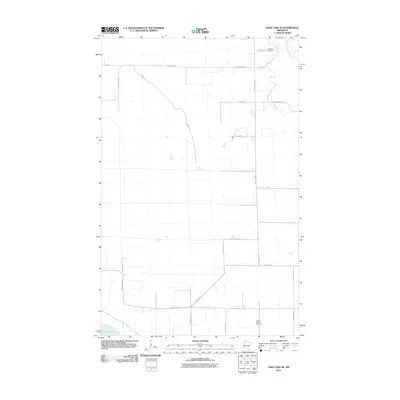
2010 Map of Thief Lake SE
USGS Topo · Published 2010About this map
Palmville Cemetery and Moose River Cemetery mark the sparse settlement pattern of this rural area in Roseau County. The landscape is defined by the winding course of Mickinock Creek and the South Fork Roseau River, which drain the low-lying terrain. Human infrastructure follows a rigid grid of section-line roads, including County Hwy-8 and County Hwy-127, though the diagonal path of Ridge Rd suggests an older route dictated by the natural topography. In the southwest corner, the edge of Thief Lake appears, a focal point for the regional hydrology. The map illustrates a contemporary rural environment where large-scale agriculture and conservation efforts meet, anchored by these remote burial grounds and the persistent drainage networks of the Red River Basin.
Find a feature on this map
22 named features on this map. Tap any name to fly to it.
Don’t see what you’re looking for? This feature index may not catch every label — zoom into the map to look around manually.
Map Details
Editions of this 2010 Thief Lake SE Map
This is the sole edition of this map. No revisions or reprints were ever made.
Other maps of this area

1918 · Rollis
USGS Topo · 1:62,500

1918 · Pencer
USGS Topo · 1:62,500

1918 · Garland
USGS Topo · 1:62,500

1919 · Liner
USGS Topo · 1:62,500

1943 · Rollis
USGS Topo · 1:62,500

1954 · Roseau
USGS Topo · 1:250,000

1957 · Roseau
USGS Topo · 1:250,000

1958 · Roseau
USGS Topo · 1:250,000
1962 · Gatzke NW
USGS Topo · 1:24,000

1962 · Gatzke
USGS Topo · 1:24,000