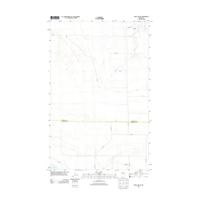
2013 Map of Thief Lake SE
USGS Topo · Published 2013About this map
The S Fork Roseau River and its tributary Mickinock Cr define the hydrological character of this northern Minnesota landscape along the border of Roseau and Marshall counties. This 2013 survey illustrates a rural terrain where straight-line section roads like Wilson Rd and Dunham Rd bisect large tracts of land, typical of the area's agricultural and conservation history. Evidence of the region's early community centers is preserved at Palmville Cem in the north and Moose River Cem near the southern boundary. In the southwest corner, the map provides detail for the approach to Thief Lake via Refuge Rd, marking the edge of significant wetland habitats. This documentation serves as a precise record of the road network and water features that have sustained local life since the original settlement period.
Find a feature on this map
19 named features on this map. Tap any name to fly to it.
Don’t see what you’re looking for? This feature index may not catch every label — zoom into the map to look around manually.
Map Details
Editions of this 2013 Thief Lake SE Map
This is the sole edition of this map. No revisions or reprints were ever made.
Other maps of this area
1918 · Rollis
USGS Topo · 1:62,500
1918 · Pencer
USGS Topo · 1:62,500
1918 · Garland
USGS Topo · 1:62,500
1919 · Liner
USGS Topo · 1:62,500
1943 · Rollis
USGS Topo · 1:62,500

1954 · Roseau
USGS Topo · 1:250,000

1957 · Roseau
USGS Topo · 1:250,000

1958 · Roseau
USGS Topo · 1:250,000
1962 · Gatzke NW
USGS Topo · 1:24,000
1962 · Gatzke
USGS Topo · 1:24,000