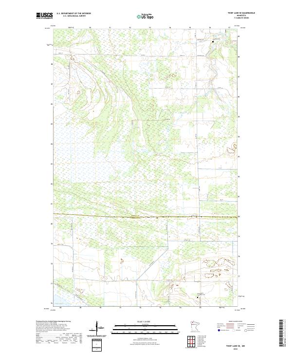
2022 Map of Thief Lake SE
USGS Topo · Published 2022About this map
Thief Lake dominates the southwestern corner of this northern Minnesota landscape, where the waters of Mickinock Cr wind through an extensive network of wetlands. This area, straddling the border between Roseau and Marshall counties, is defined by a sparse but deliberate grid of country roads and section lines that navigate the marshy terrain. The presence of Palmville Cem in the northeast and Moose River Township Cem to the southeast provides significant touchstones for genealogical research, anchoring the history of these townships. Settlement patterns follow specific corridors like Ridge Rd and Co Hwy 48, illustrating how local infrastructure was adapted to the natural hydrology of the region. The map also details several modern access points such as Refuge Rd and Thief Lake Dr NE, which serve the conserved areas surrounding the lake.
Find a feature on this map
35 named features on this map. Tap any name to fly to it.
Don’t see what you’re looking for? This feature index may not catch every label — zoom into the map to look around manually.
Map Details
Editions of this 2022 Thief Lake SE Map
This is the sole edition of this map. No revisions or reprints were ever made.
Other maps of this area

1918 · Rollis
USGS Topo · 1:62,500

1918 · Pencer
USGS Topo · 1:62,500

1918 · Garland
USGS Topo · 1:62,500

1919 · Liner
USGS Topo · 1:62,500

1943 · Rollis
USGS Topo · 1:62,500

1954 · Roseau
USGS Topo · 1:250,000

1957 · Roseau
USGS Topo · 1:250,000

1958 · Roseau
USGS Topo · 1:250,000
1962 · Gatzke NW
USGS Topo · 1:24,000

1962 · Gatzke
USGS Topo · 1:24,000