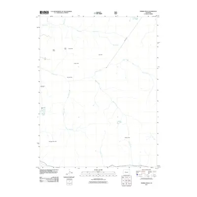
2011 Map of Thimble Rock
USGS Topo · Published 2011About this map
Smuggler Mountain and the high ridges of the Sawatch Range define this landscape, where mining infrastructure and water management systems reflect the region's industrial heritage. The Tower Durant Tunnel Mine and the significant Hunter Tunnel demonstrate the extensive subsurface engineering required to extract resources from these heights. The map details a complex hydrologic network feeding into the Roaring Fork River, including Warren Lakes and the Warren Lake Dam. Elevated basins such as Deer Park, Horse Park, and Slab Park are interspersed between prominent landmarks like Thimble Rock and Bald Knob. This 2011 survey captures the area's high-altitude geography, from the crossing at Midway Pass to the alpine waters of Sawyer Lake and Midway Lake, providing a clear view of the terrain before more recent environmental shifts.
Find a feature on this map
24 named features on this map. Tap any name to fly to it.
Don’t see what you’re looking for? This feature index may not catch every label — zoom into the map to look around manually.
Map Details
Editions of this 2011 Thimble Rock Map
This is the sole edition of this map. No revisions or reprints were ever made.
Other maps of this area

1893 · Aspen
USGS Topo · 1:62,500

1895 · Aspen
USGS Topo · 1:62,500

1909 · Mount Jackson
USGS Topo · 1:125,000

1911 · Mount Jackson
USGS Topo · 1:125,000

1957 · Leadville
USGS Topo · 1:250,000

1959 · Leadville
USGS Topo · 1:250,000

1960 · Leadville
USGS Topo · 1:250,000
1960 · Hayden Peak
USGS Topo · 1:24,000
1960 · New York Peak
USGS Topo · 1:24,000
1960 · Thimble Rock
USGS Topo · 1:24,000