1960 Map of New York Peak
USGS Topo · Published 1964About this map
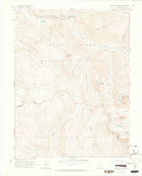
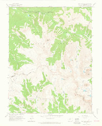
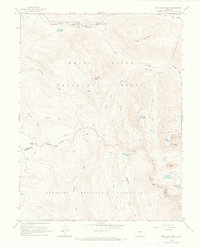
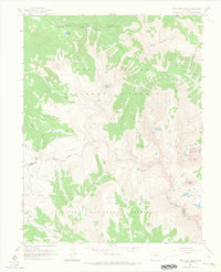
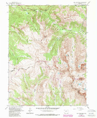
New York Peak towers over a landscape defined by the intersection of the White River National Forest and Gunnison National Forest. This 1960 era survey reveals an intricate network of high-altitude water management, including the New York Collection Canal and the Twin Lakes Reservoir Tunnel No 2, which diverted snowmelt through the Continental Divide. Along the Roaring Fork River, established recreation sites like The Grottos and Devils Punchbowl sit near various campgrounds, including Lincoln Gulch Campground and Grottos Campground. The terrain is marked by remote alpine basins holding Tabor Lake, Tellurium Lake, and Petroleum Lake, all connected by a series of high-country pack trails. The map serves as a detailed record of mid-century hydraulic engineering and early wilderness recreation in the Sawatch Range.
Find a feature on this map
41 named features on this map. Tap any name to fly to it.
Don’t see what you’re looking for? This feature index may not catch every label — zoom into the map to look around manually.
Map Details
Editions of this 1960 New York Peak Map
5 editions found
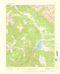
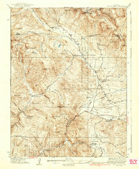
Other maps of this area

1888 · Crested Butte
USGS Topo · 1:62,500

1889 · Crested Butte
USGS Topo · 1:62,500

1893 · Crested Butte
USGS Topo · 1:62,500

1893 · Aspen
USGS Topo · 1:62,500

1895 · Aspen
USGS Topo · 1:62,500

1909 · Mount Jackson
USGS Topo · 1:125,000

1911 · Mount Jackson
USGS Topo · 1:125,000
1934 · Taylor Park
USGS Topo · 1:62,500
1937 · Taylor Park
USGS Topo · 1:62,500

1956 · Montrose
USGS Topo · 1:250,000