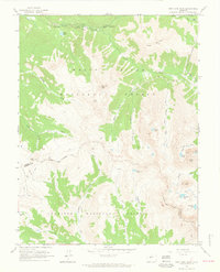
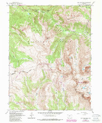
1960 Map of New York Peak
USGS Topo · Published 1964About this map
New York Peak dominates the center of this high-altitude landscape where the White River National Forest meets the Gunnison National Forest. The 1960 survey records a complex water diversion network, featuring the Lincoln Gulch Canal, an underground Aqueduct, and the Twin Lakes Reservoir Tunnel No 2, reflecting the mid-century engineering required to manage mountain runoff.
Find a feature on this map
42 named features on this map. Tap any name to fly to it.
Don’t see what you’re looking for? This feature index may not catch every label — zoom into the map to look around manually.
Map Details
Editions of this 1960 New York Peak Map
5 editions found
Other maps of this area

1888 · Crested Butte
USGS Topo · 1:62,500

1889 · Crested Butte
USGS Topo · 1:62,500

1893 · Crested Butte
USGS Topo · 1:62,500

1893 · Aspen
USGS Topo · 1:62,500

1895 · Aspen
USGS Topo · 1:62,500

1909 · Mount Jackson
USGS Topo · 1:125,000

1911 · Mount Jackson
USGS Topo · 1:125,000

1934 · Taylor Park
USGS Topo · 1:62,500

1937 · Taylor Park
USGS Topo · 1:62,500

1956 · Montrose
USGS Topo · 1:250,000