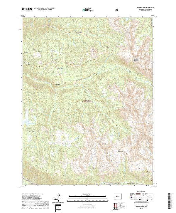
2022 Map of Thimble Rock
USGS Topo · Published 2022About this map
White River National Forest defines the high-altitude landscape of this 2022 survey, dominated by the prominent peak of Smuggler Mtn and the distinct formation of Thimble Rock. The terrain is characterized by a series of high parks and flats, including Slab Park, Deer Park, and Hunter Flats, which suggest a topography of elevated plateaus separated by steep drainages. A network of traditional routes like the Midway Trl and Woody Creek Trl provides access through this wilderness, crossing critical divides such as Midway Pass.
Find a feature on this map
34 named features on this map. Tap any name to fly to it.
Don’t see what you’re looking for? This feature index may not catch every label — zoom into the map to look around manually.
Map Details
Editions of this 2022 Thimble Rock Map
This is the sole edition of this map. No revisions or reprints were ever made.
Other maps of this area

1893 · Aspen
USGS Topo · 1:62,500

1895 · Aspen
USGS Topo · 1:62,500

1909 · Mount Jackson
USGS Topo · 1:125,000

1911 · Mount Jackson
USGS Topo · 1:125,000

1957 · Leadville
USGS Topo · 1:250,000

1959 · Leadville
USGS Topo · 1:250,000

1960 · Leadville
USGS Topo · 1:250,000
1960 · Hayden Peak
USGS Topo · 1:24,000
1960 · New York Peak
USGS Topo · 1:24,000
1960 · Thimble Rock
USGS Topo · 1:24,000