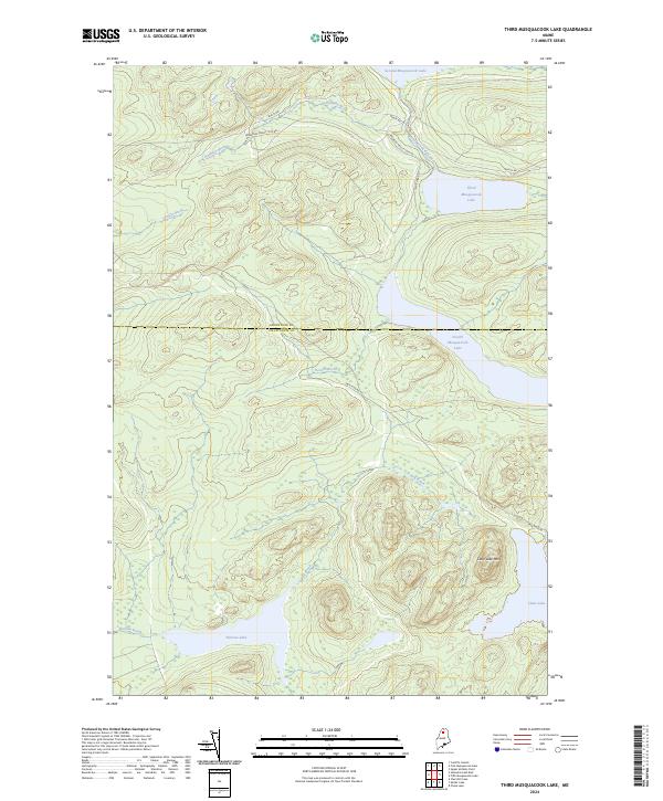
2024 Map of Third Musquacook Lake
USGS Topo · Published 2024About this map
Third Musquacook Lake and its surrounding chain of waters dominate this remote northern Maine landscape at the border of Aroostook and Piscataquis Counties. This 2024 map documents the vital network of working forest roads, including the American Realty Tote Rd and Realty Rd, which have long served the timber industry in this region. The terrain is defined by low-lying wetlands like Bog Brook and significant elevations such as Clear Lake Mtn, providing a detailed look at the hydrology that feeds into Second Musquacook Lake and Fourth Musquacook Lake. The presence of the Jack Mtn Rd near the shores of Clear Lake illustrates how access to these deep interior waterways remains tied to established logging and hauling routes. Researchers can trace the flow of Halfway Brook and Glazier Brook as they carve through the dense forest towards the Musquacook Stream system.
Find a feature on this map
17 named features on this map. Tap any name to fly to it.
Don’t see what you’re looking for? This feature index may not catch every label — zoom into the map to look around manually.
Map Details
Editions of this 2024 Third Musquacook Lake Map
This is the sole edition of this map. No revisions or reprints were ever made.
Other maps of this area

1932 · Umsaskis Lake
USGS Topo · 1:48,000

1932 · Musquacook Lakes
USGS Topo · 1:48,000

1935 · Umsaskis Lake
USGS Topo · 1:62,500

1935 · Musquacook Lakes
USGS Topo · 1:62,500

1954 · Spider Lake
USGS Topo · 1:62,500

1954 · Churchill Lake
USGS Topo · 1:62,500

1954 · Presque Isle
USGS Topo · 1:250,000

1958 · Presque Isle
USGS Topo · 1:250,000

1960 · Presque Isle
USGS Topo · 1:250,000

1961 · Spider Lake
USGS Topo · 1:62,500