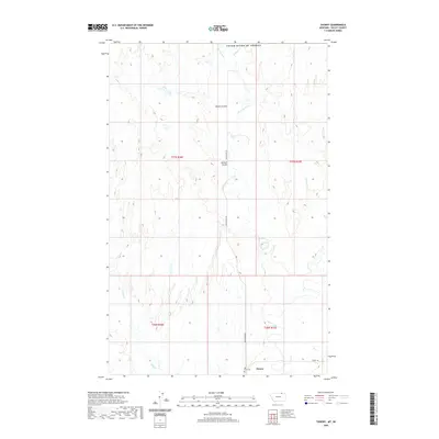
2020 Map of Thoeny
USGS Topo · Published 2020About this map
Thoeny sits at the southern edge of this modern survey, marking a quiet settlement near the headwaters of Rock Creek. The landscape is defined by the complex drainage patterns of the high plains just south of the border with the United States' northern neighbor, where seasonal watercourses like McEachern Creek and Bluff Cr have carved distinct paths through the terrain. The presence of Hill Crest Cem north of the main settlement provides a specific point of interest for those researching local family histories in this part of Valley County. Coulees such as Dolson Coulee and Davison Coulee break the prairie, showing the subtle topographical shifts that dictate land use and road placement, including McEachern Rd and Theony Rd.
Find a feature on this map
17 named features on this map. Tap any name to fly to it.
Don’t see what you’re looking for? This feature index may not catch every label — zoom into the map to look around manually.
Map Details
Editions of this 2020 Thoeny Map
This is the sole edition of this map. No revisions or reprints were ever made.
Other maps of this area

1919 · Boundary
USGS Topo · 1:125,000

1954 · Glasgow
USGS Topo · 1:250,000

1957 · Glasgow
USGS Topo · 1:250,000

1958 · Glasgow
USGS Topo · 1:250,000

1984 · Lighthouse Hill
USGS Topo · 1:24,000

1984 · Snake Creek School
USGS Topo · 1:24,000

1984 · Black Calf Reservoir
USGS Topo · 1:24,000

1984 · Opheim
USGS Topo · 1:100,000

1984 · Last Chance Reservoir
USGS Topo · 1:24,000
1984 · Thoeny
USGS Topo · 1:24,000