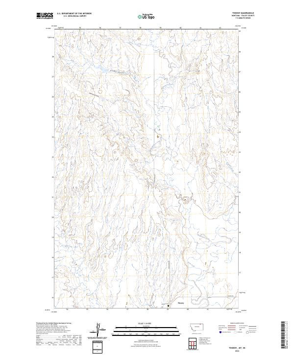
2024 Map of Thoeny
USGS Topo · Published 2024About this map
Thoeny sits at the southern edge of this landscape in Valley County, where the high plains are carved by a network of drainage coulees and seasonal creeks. The settlement is anchored by the presence of Hillcrest Cem, while two primary local routes, McEachern Rd and Theony Rd, provide the only significant infrastructure through the surrounding range.
Find a feature on this map
14 named features on this map. Tap any name to fly to it.
Don’t see what you’re looking for? This feature index may not catch every label — zoom into the map to look around manually.
Map Details
Editions of this 2024 Thoeny Map
This is the sole edition of this map. No revisions or reprints were ever made.
Other maps of this area

1919 · Boundary
USGS Topo · 1:125,000

1954 · Glasgow
USGS Topo · 1:250,000

1957 · Glasgow
USGS Topo · 1:250,000

1958 · Glasgow
USGS Topo · 1:250,000

1984 · Lighthouse Hill
USGS Topo · 1:24,000

1984 · Snake Creek School
USGS Topo · 1:24,000

1984 · Black Calf Reservoir
USGS Topo · 1:24,000

1984 · Opheim
USGS Topo · 1:100,000

1984 · Last Chance Reservoir
USGS Topo · 1:24,000
1984 · Thoeny
USGS Topo · 1:24,000