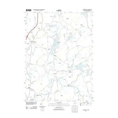
2012 Map of Thompson
USGS Topo · Published 2012About this map
Marianopolis College and the surrounding hilltop community of Thompson serve as the western anchors for this landscape near the Connecticut-Rhode Island state line. The terrain is defined by the Fivemile River valley and significant reservoirs, including Bowdish Reservoir and the central Quaddick Lake Seaplane Base. This 2012 survey illustrates a mix of traditional New England settlement patterns and modern recreational uses, such as the Thompson Raceway and Raceway Golf Course. Genealogists will find numerous family-named landmarks and historical burial grounds, including Munyan Cem, Putnam Heights Cem, and Harrington Cem. Smaller hamlets like East Putnam and Ballouville are connected by a network of local roads that navigate around numerous ledges and hills like Benson Mountain and Quaddick Mountain.
Find a feature on this map
171 named features on this map. Tap any name to fly to it.
Don’t see what you’re looking for? This feature index may not catch every label — zoom into the map to look around manually.
Map Details
Editions of this 2012 Thompson Map
This is the sole edition of this map. No revisions or reprints were ever made.
Other maps of this area

1886 · Blackstone
USGS Topo · 1:62,500

1889 · Blackstone
USGS Topo · 1:62,500

1889 · Webster
USGS Topo · 1:62,500

1889 · Putnam
USGS Topo · 1:62,500

1889 · Burrillville
USGS Topo · 1:62,500

1892 · Webster
USGS Topo · 1:62,500

1893 · Putnam
USGS Topo · 1:62,500

1893 · Blackstone
USGS Topo · 1:62,500

1894 · Burrillville
USGS Topo · 1:62,500

1900 · Blackstone
USGS Topo · 1:62,500