
1976 Map of Thompsonville NE
USGS Topo · Published 1976About this map
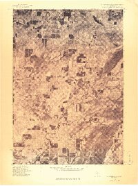
Lake Ann sits near the northern boundary of this mid-1970s orthophoto, a rare aerial view of the Michigan landscape before modern expansion. This imagery, captured by the Geological Survey, reveals the intricate relationship between the region's dense woodlands and its scattered agricultural clearings. The map documents the established lakeside communities of Interlochen and the rural junction of Bendon, providing a literal look at the road networks and shoreline developments of the era. To the east and south, the major water bodies of Long Lake, Green Lake, and Duck Lake dominate the terrain, their irregular shorelines showing the extent of residential and recreational activity during this period. Researchers can clearly identify the patterns of woodlots and orchards that defined the local economy before the late-century shift toward more intensive suburban development.
Find a feature on this map
6 named features on this map. Tap any name to fly to it.
Don’t see what you’re looking for? This feature index may not catch every label — zoom into the map to look around manually.
Map Details
Editions of this 1976 Thompsonville NE Map
This is the sole edition of this map. No revisions or reprints were ever made.
Other maps of this area

1954 · Traverse City
USGS Topo · 1:250,000

1956 · Kingsley
USGS Topo · 1:62,500

1956 · Thompsonville
USGS Topo · 1:62,500

1957 · Traverse City
USGS Topo · 1:62,500

1957 · Maple City
USGS Topo · 1:62,500

1958 · Traverse City
USGS Topo · 1:250,000
1976 · Thompsonville SW
USGS Topo · 1:24,000

1976 · Thompsonville NW
USGS Topo · 1:24,000

1976 · Thompsonville SE
USGS Topo · 1:24,000
1983 · Thompsonville
USGS Topo · 1:25,000
Featured Places
- Long Lake Township, MI
- Long Lake Charter Township, Long Lake Township
- Green Lake Township, MI
- Interlochen, Green Lake Township
- Hardwood Acres, MI