2024 Map of Thonotosassa
USGS Topo · Published 2024About this map
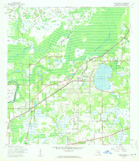
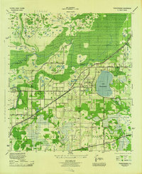
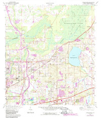
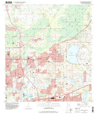
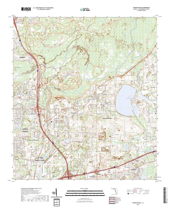
Lake Thonotosassa anchors this landscape northeast of Tampa, where the waters of Flint Creek and Campbell Branch gather before flowing toward the Hillsborough River. This modern survey reveals a complex interface of suburban development and extensive environmental management, dominated by the Lower Hillsborough Flood Detention Area and its network of trails like the Flatwoods Park Trl. The map documents the persistent identity of established communities such as Thonotosassa, Clarkwild, and Mango, while also noting newer institutional landmarks like the University of Phoenix West Florida Campus. Significant local heritage is preserved in sites like the Antioch Cem and Sunset Memory Gardens Cem, nestled alongside major transit corridors including the Tampa Executive Airport and the historic route of the Old Fort King Trl.
Find a feature on this map
45 named features on this map. Tap any name to fly to it.
Don’t see what you’re looking for? This feature index may not catch every label — zoom into the map to look around manually.
Map Details
Editions of this 2024 Thonotosassa Map
This is the sole edition of this map. No revisions or reprints were ever made.
Historical Maps of Tampa Through Time
5 maps found