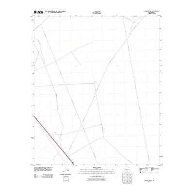
2010 Map of Thorn Well
USGS Topo · Published 2010About this map
Thorn Well serves as the central namesake for this landscape in the northern Chihuahuan Desert during the early 21st century. The terrain is defined by a sparse but organized network of utility and transit corridors, notably the long diagonal of Power Line Rd and several interconnected thoroughfares such as County Rd-E074. This area of New Mexico demonstrates the essential role of water management in an arid environment, evidenced by the presence of Lake Tank in the southwestern quadrant. The rectilinear grid of the county road system, including County Rd-E073 and County Rd-E078, suggests a landscape partitioned for ranching or resource management rather than dense residential settlement. This survey provides a clear view of the infrastructure supporting this remote part of Doña Ana County, where man-made catchments and named wells are critical landmarks.
Find a feature on this map
10 named features on this map. Tap any name to fly to it.
Don’t see what you’re looking for? This feature index may not catch every label — zoom into the map to look around manually.
Map Details
Editions of this 2010 Thorn Well Map
This is the sole edition of this map. No revisions or reprints were ever made.
Other maps of this area

1916 · Tonuco
USGS Topo · 1:125,000

1932 · Tonuco
USGS Topo · 1:125,000

1948 · Chicken Well
USGS Topo · 1:62,500

1948 · San Diego Mountain
USGS Topo · 1:62,500

1955 · Las Cruces
USGS Topo · 1:250,000

1958 · Las Cruces
USGS Topo · 1:250,000
1959 · Sierra Alta
USGS Topo · 1:24,000

1959 · Rincon
USGS Topo · 1:24,000

1959 · Upham
USGS Topo · 1:62,500

1981 · Gilmore Draw
USGS Topo · 1:24,000