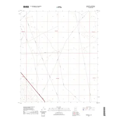
2020 Map of Thorn Well
USGS Topo · Published 2020About this map
Thorn Well serves as the central namesake of this high desert landscape in Doña Ana County, reflecting the sparse infrastructure required for ranching and utility management in southern New Mexico. The terrain is defined by a network of county roads including Co Rd E073, Co Rd E074, and Co Rd E078 that cut across the Public Land Survey System township and range lines. A seasonal or livestock-related water source is noted at Lake Tank in the southwestern quadrant, while the prominent Power Line Rd tracks through the center of the sheet. This map captures the modern distribution of land and resources, illustrating how isolated water points and utility corridors dictate the human footprint in this arid region.
Find a feature on this map
15 named features on this map. Tap any name to fly to it.
Don’t see what you’re looking for? This feature index may not catch every label — zoom into the map to look around manually.
Map Details
Editions of this 2020 Thorn Well Map
This is the sole edition of this map. No revisions or reprints were ever made.
Other maps of this area

1916 · Tonuco
USGS Topo · 1:125,000

1932 · Tonuco
USGS Topo · 1:125,000

1948 · Chicken Well
USGS Topo · 1:62,500

1948 · San Diego Mountain
USGS Topo · 1:62,500

1955 · Las Cruces
USGS Topo · 1:250,000

1958 · Las Cruces
USGS Topo · 1:250,000
1959 · Sierra Alta
USGS Topo · 1:24,000

1959 · Rincon
USGS Topo · 1:24,000

1959 · Upham
USGS Topo · 1:62,500

1981 · Gilmore Draw
USGS Topo · 1:24,000